Category: Events

  • CROFT BIOGRAPHIES — ELPHIN CROFTY DAY 12 September 2026

    From Maps to Memories: Building a Biography of a Croft

    We are delighted to have been invited to have a stall at Elphin Crofty Day on Saturday 12 September 2026.

    Every croft has a history shaped by the people who lived and worked there, changes in tenancy, boundaries, land use and the wider story of the township.

    Date: Saturday 12 September 2026
    Location: Elphin Village Hall
    Booking: Not required

    Historic Assynt will bring material from the archive to Elphin Crofty Day to trial a new approach to creating individual Croft Biographies.

    Using historic maps, croft records and other documentary sources, we will explore how the story of an individual croft can be traced through time.

    What we’ll be doing

    People will be able to explore Historic Assynt’s records alongside historic mapping, including nineteenth-century croft and tenancy information.

    We will demonstrate techniques such as:

    • tracing a croft through successive maps;
    • comparing historic and modern boundaries;
    • using tenancy and estate records;
    • identifying former buildings and land use;
    • combining documentary evidence with family and community knowledge.

    The aim is to begin creating a simple, repeatable Croft Biography format which can be developed as further information comes to light.

    We will introduce basic desk-based research, map regression and archive research techniques.

    It will also help us test a methodology which could later be used for workshops elsewhere in Assynt.

    Who is it for?

    Anyone interested in crofting, local history, family history, maps or the changing Assynt landscape.

    This is primarily a desk-based activity. Historic Assynt will provide the archive and mapping material.

    Come along and enjoy Elphin’s Crofty Day and hopefully see you there (formerly Elphin Chicken Day).

    Part of Historic Assynt’s (Re) Connecting Communities: Stage 2 — taking the archive into the landscape and turning local knowledge into practical heritage skills.
  • KYLESKU — GEOLOGY & ARCHAEOLOGY – NEW DATE TO BE ADVISED

    Kylesku: Reading Rocks and Ruins

    Reading the landscape, recording the past.

    Join Historic Assynt and the North West Highlands Geopark for a day exploring how geology, archaeology and people have shaped the Kylesku landscape.

    Based at the Rock Stop, the day will begin with a short introduction to reading a landscape before heading outdoors for a jointly led geology and archaeology walk.

    Using historic maps, aerial photographs, geological information and archaeological records, we will look at some of the ways we can investigate a place before ever setting foot in the field. We will also introduce some simple archaeological recording techniques before putting them into practice during the walk.

    Rock Stop, Unapool/Kylesku
    Date: Saturday 19 September 2026

    What to expect

    The day will include:

    • historic maps, photographs and archive material relating to Kylesku and Unapool;
    • an introduction to desk-based landscape research;
    • a short introduction to archaeological and building recording;
    • a joint guided geology and archaeology walk led by Historic Assynt and the North West Highlands Geopark;
    • opportunities to examine and record archaeological features in the landscape;
    • discussion of how geology has influenced settlement, building materials, routes and land use;
    • opportunities to share local knowledge, place-names and memories.

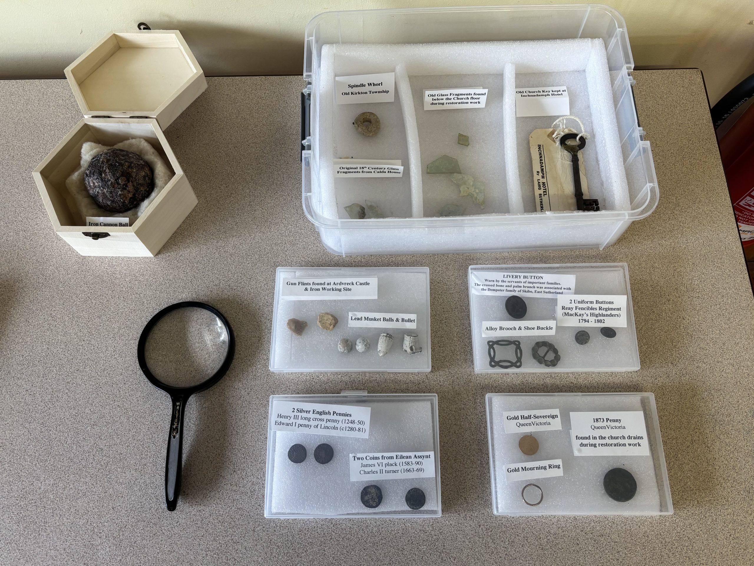
    A small heritage display will also be available at the Rock Stop during the day.

    Programme

    10.00am – Welcome and registration at the Rock Stop
    10.30am – Reading the Kylesku landscape: maps, records and desk-based research
    11.15am – Introduction to archaeological and building recording
    11.45am – Lunch
    12.15pm – Joint geology and archaeology walk
    3.15pm – Return to the Rock Stop for refreshments
    3.45pm – Findings, discussion and what we might investigate next
    4.30pm – Finish

    Tea, coffee and light refreshments will be provided.

    Please bring your own lunch.

    Booking

    The guided walk will be a bookable activity, with places limited to ensure that everyone has an opportunity to take part in the recording and discussion.

    Booking details will be available shortly through the North West Highlands Geopark.

    No previous knowledge of geology or archaeology is required — the day is designed for anyone interested in discovering more about the Kylesku landscape and learning how we can investigate and record the evidence around us.

    A joint Historic Assynt and North West Highlands Geopark event, part of Historic Assynt’s wider Celebrating Our Heritage programme.

  • FISHING IN ASSYNT – Saturday 24 October 2026

    Harbour, Boats & Fishing: Lochinver’s Living Maritime Heritage

    Fishing has shaped Lochinver and Assynt in many different ways — from earlier herring fisheries and local boats to the twentieth-century white-fish industry, the development of the harbour and the experiences of the people who worked at sea and ashore.

    Date: Saturday 24 October 2026
    Venue: Assynt Leisure Centre, Lochinver
    Booking: Click here to book

    About the event

    This event will bring archive sources, film, personal memories and the modern harbour together to explore fishing as a living heritage.

    What we’ll be doing

    The programme is being developed around several complementary activities, including:

    • archive photographs, maps and records;
    • a screening of the short film Herring Stories;
    • a talk by Dave McBain drawing on his research into fishing in Assynt;
    • discussion with people connected to fishing and the harbour;
    • opportunities to contribute photographs, stories and memories;
    • stalls from the RNLI and Assynt Ranger
    • a short heritage walk around the village and harbour, finishing in the Culag Hotel

    What you’ll learn

    Rather than concentrating solely on archaeology, this event explores how historians record a living industry.

    Participants will see how maps, photographs, newspapers, oral history and personal collections can be combined to tell the story of a place.

    Who is it for?

    Everyone.

    We would particularly like to hear from people with memories, photographs or family connections to fishing, the harbour, boats and associated businesses.

    You don’t need to consider yourself an historian — lived experience is part of the historical record.

    Accessibility

    Much of the event will take place indoors. Any outdoor heritage walk will be optional and further accessibility information will be provided once the programme is confirmed.

    Part of Historic Assynt: (Re) Connecting Communities Stage 2 — connecting archives, landscapes and the people who know them best.

  • Drumbeg Heritage 2-day event – Friday 16 & Saturday 17 October 2026

    Drumbeg Heritage 2-day event – Friday 16 & Saturday 17 October 2026

    Reading and Recording the Drumbeg Landscape

    Historic maps show that Drumbeg sits within a much older landscape of settlement, cultivation, routes, peat working and community life.

    This two-day event will use the village hall as a base for exploring that landscape through archive research and practical field recording.

    The days will move from the historic Drumbeg township and Peat Road to the burial landscape at Nedd.

    Dates: Friday 16– Saturday 17 October 2026
    Base: Drumbeg Village Hall
    Booking: Details to follow

    Day One — Drumbeg and the Peat Road

    We will begin indoors with archive material and historic maps, looking at how Drumbeg developed and what documentary sources can tell us before we enter the field.

    Working with the Assynt Ranger, we will then walk part of the Drumbeg Peat Road and explore the archaeology, history and natural landscape along the route.

    Participants will learn how to look for evidence of past settlement and land use and how observations made in the field can be related back to historic maps and records.

    Day Two — Recording at Nedd

    The second day will focus on the historic graveyard at Nedd.

    Participants will be introduced to simple monument recording and archaeological photography techniques before helping to create a consistent record of surviving grave markers and other features.

    What you’ll learn

    Across the two days we will introduce:

    • map regression;
    • desk-based archaeological research;
    • landscape observation;
    • basic site recording;
    • grave-marker recording;
    • archaeological photography.

    Who is it for?

    Anyone interested in Drumbeg, Nedd, local history, archaeology or learning practical recording skills.

    You are welcome to attend one or both days, subject to final booking arrangements.

    No previous archaeological experience is necessary.

    What to bring / accessibility

    Field activities will involve outdoor walking and uneven ground. Suitable footwear and waterproof clothing will be required.

    More detailed information about routes, accessibility and refreshments will be provided when booking opens.

    Part of Historic Assynt: (Re)Connecting Communities Stage 2 — taking the archive into the landscape and turning local knowledge into practical heritage skills.